
Mouza Map Measure
Measure land straight from Mouza map images - Katha, Bigha, Shotok, offline.
Mouza Map Measure - Land Survey & Plot Measurement, Made Simple
Draw it. Divide it. Know exactly how much land you have - in Katha, Bigha, Shotok, and more. 100% offline. 100% free of clutter.
About the app
Mouza Map Measure specializes in measuring land directly from land map images - above all, the Mouza maps of Bangladesh. Load a photo, scan, or PDF of a mouza map (or any porcha/naksha), calibrate it with one known distance, and trace any plot to get its true area in the units your deed uses. While it is built around Bangladeshi mouza maps and land units, it is equally capable of measuring any map, site plan, floor plan, or image - if you know one real distance on the picture, the app can measure everything on it.
It is a fast, lightweight land measurement app built for surveyors, engineers, land buyers, and landowners in Bangladesh and West Bengal. Sketch a plot with your finger or construct it precisely from surveyed side lengths, and instantly see its area in every local unit you use - no internet, no sign-up, no waiting.
Runs smoothly even on budget and older Android phones (Android 6.0+), and the entire app is under 2 MB.
Why Mouza Map Measure?
- 🪶 Tiny & fast - under 2 MB, opens instantly, smooth on phones from 2016 onward.
- 📵 Fully offline - measure land in the field with zero network. Nothing is uploaded, ever.
- 🔒 Private by design - the app requests no permissions at all.
- 🇧🇩 Built for local units - Katha, Bigha, Shotok (Decimal), Gonda, Ana, Kani, Acre, plus square feet and square meters.
- 💾 Never lose work - everything autosaves; 40 levels of undo.
Features
✏️ Interactive plot drawing
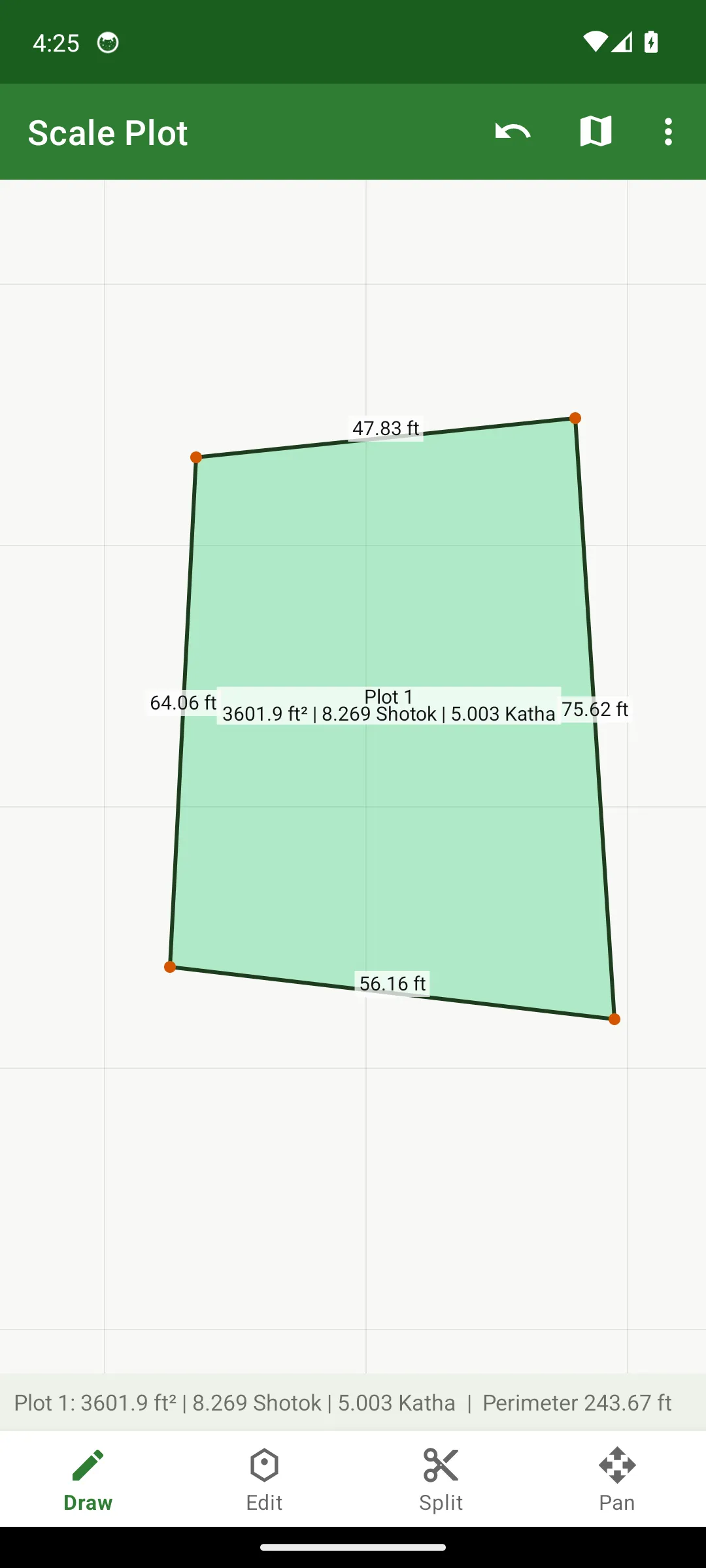
Tap the canvas to place the corners of your land - the app draws the boundary, labels every side with its live length, and shows the area right on the plot. Draw as many plots as you need side by side, each in its own color.
📐 Exact quadrilateral from survey measurements
Have the numbers from a field survey? Enter the four side lengths and one diagonal, and Mouza Map Measure constructs the exact quadrilateral using the traditional surveyor’s triangle method - the same geometry a professional amin uses on paper, done instantly and without arithmetic errors.
🗺️ Trace over real maps (mouza map / porcha / PDF)
Load a photo or scan of your mouza map - or a PDF - directly as the canvas background. Mark one known distance, calibrate, and the whole map becomes true-to-scale. Then simply trace any plot boundary to get its real area. Perfect for verifying what a deed says against what the map shows.
✂️ Split any plot along a line
Tap two edges of a plot and Mouza Map Measure cuts it cleanly along that line into two plots, each with its own instant area readout. Ideal for partition planning between family members or buyers.
⚖️ Divide into perfectly equal shares
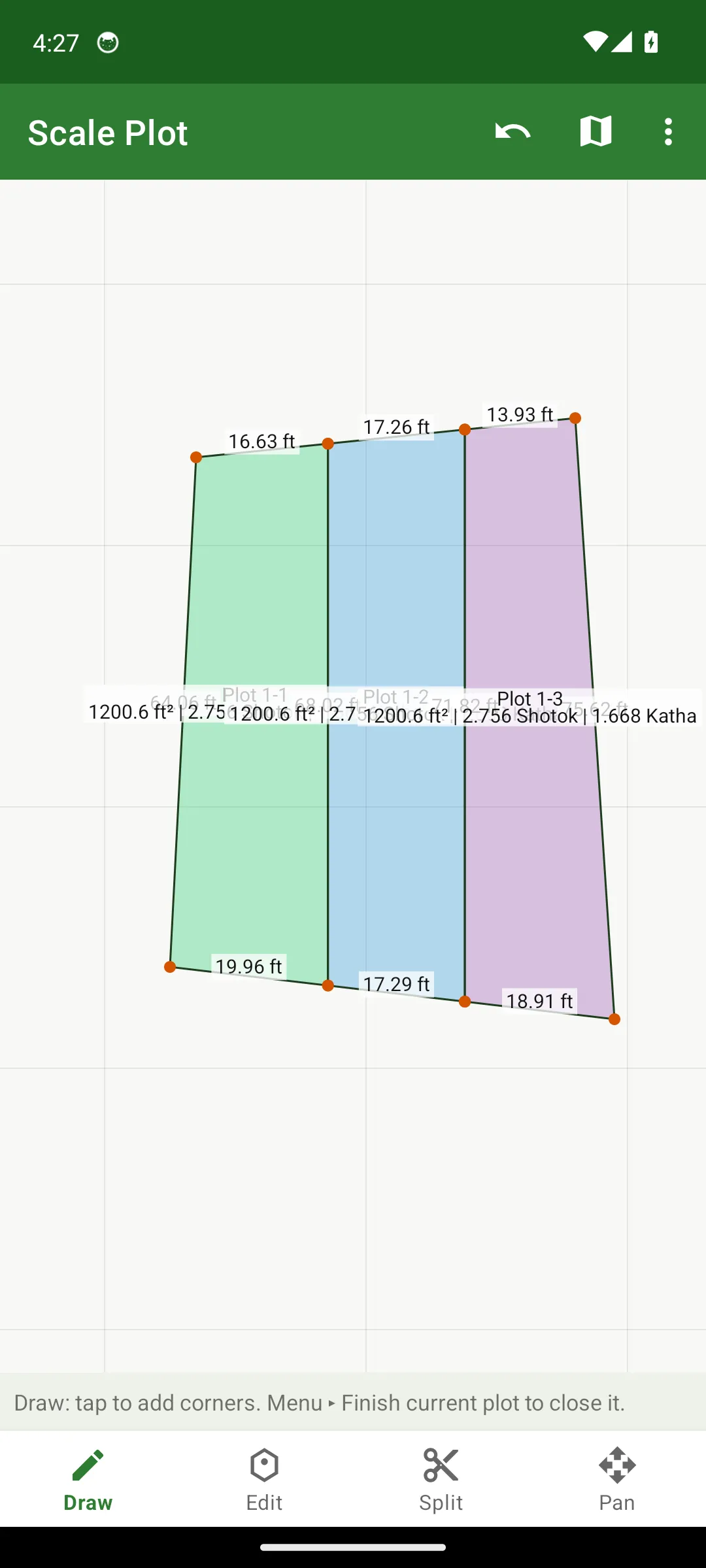
Need to split land fairly among 3 heirs? Enter the number of shares and Mouza Map Measure divides the plot into pieces of mathematically equal area - automatically, for any shape, from 2 to 20 parts.
📏 Precision editing
- Drag any corner to adjust the boundary - lengths and area update live.
- Tap a side and type its exact measured length.
- Tap a corner to see its interior angle, or remove it.
🔢 Every unit you work with
One tap shows the full breakdown of any plot: Sq Feet, Sq Meter, Shotok (Decimal), Katha, Bigha, Acre, Gonda, Ana, Kani - plus the traditional composite reading (e.g., “0 Bigha 5 Katha 0.04 Chatak”) and the perimeter. Work in feet, meters, links, or haat.
🖼️ Share your work
Export any survey as a clean, high-resolution image (saved to Pictures/ScalePlot) - ready to send on WhatsApp, print, or attach to documents.
Screenshots
| Draw & measure | Every local unit |
|---|---|
 |
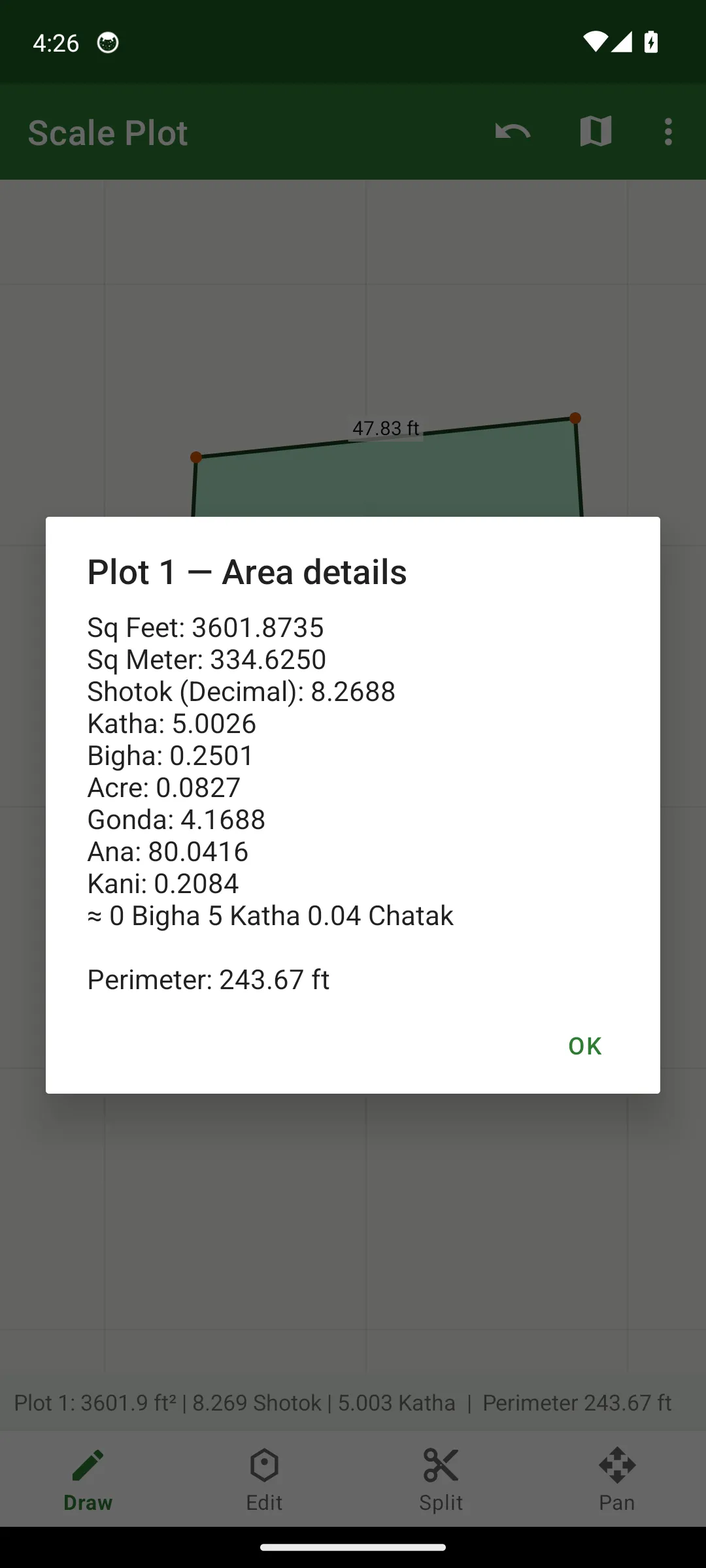 |
| Tap corners to draw - every side length and the area appear instantly. | One tap: Shotok, Katha, Bigha, Gonda, Ana, Kani, Acre & more. |
| Fair division | All tools at hand |
|---|---|
 |
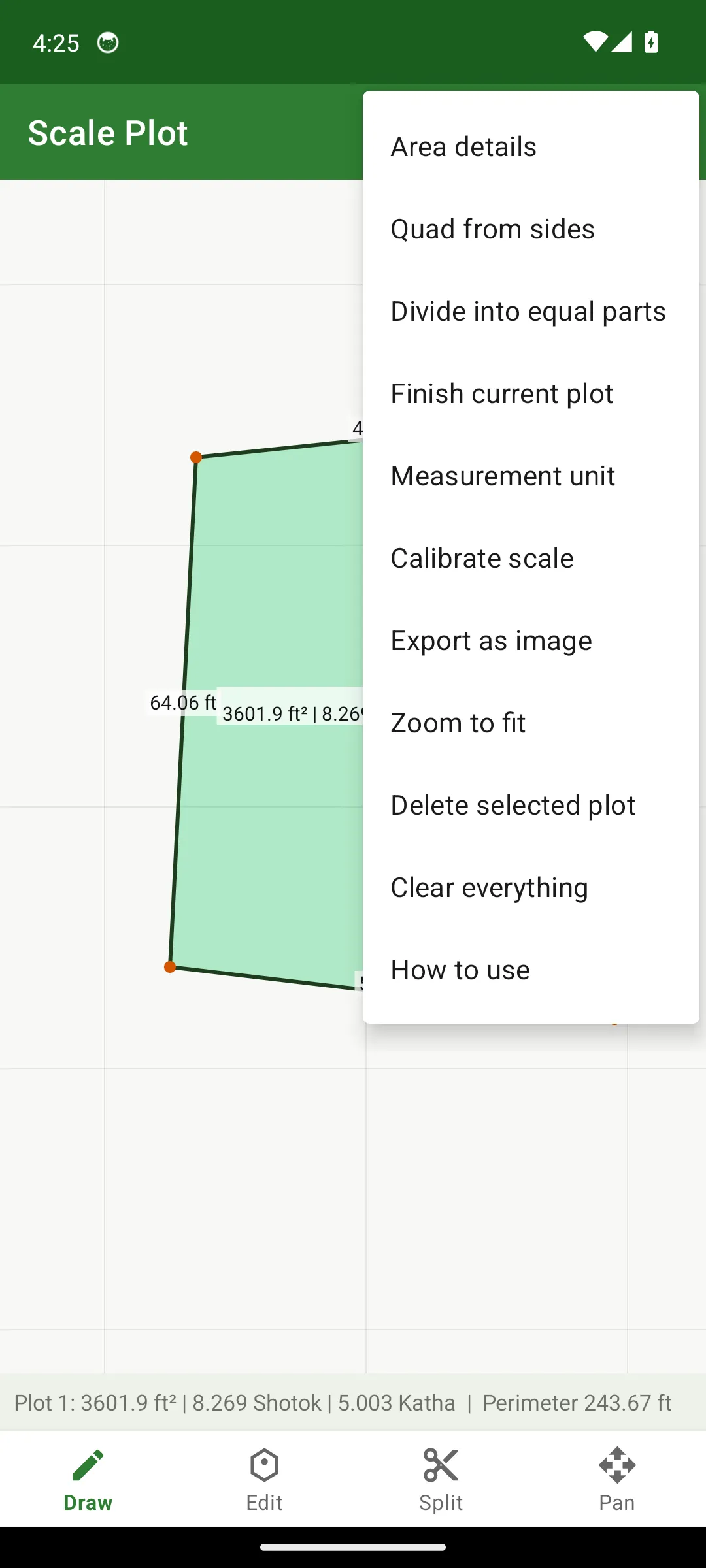 |
| Three heirs, three shares - 1200.6 ft² each, exactly. | Quad from sides, calibrate map scale, export, and more. |
On a real Mouza map
| Trace plots on the map | Edit right on the map |
|---|---|
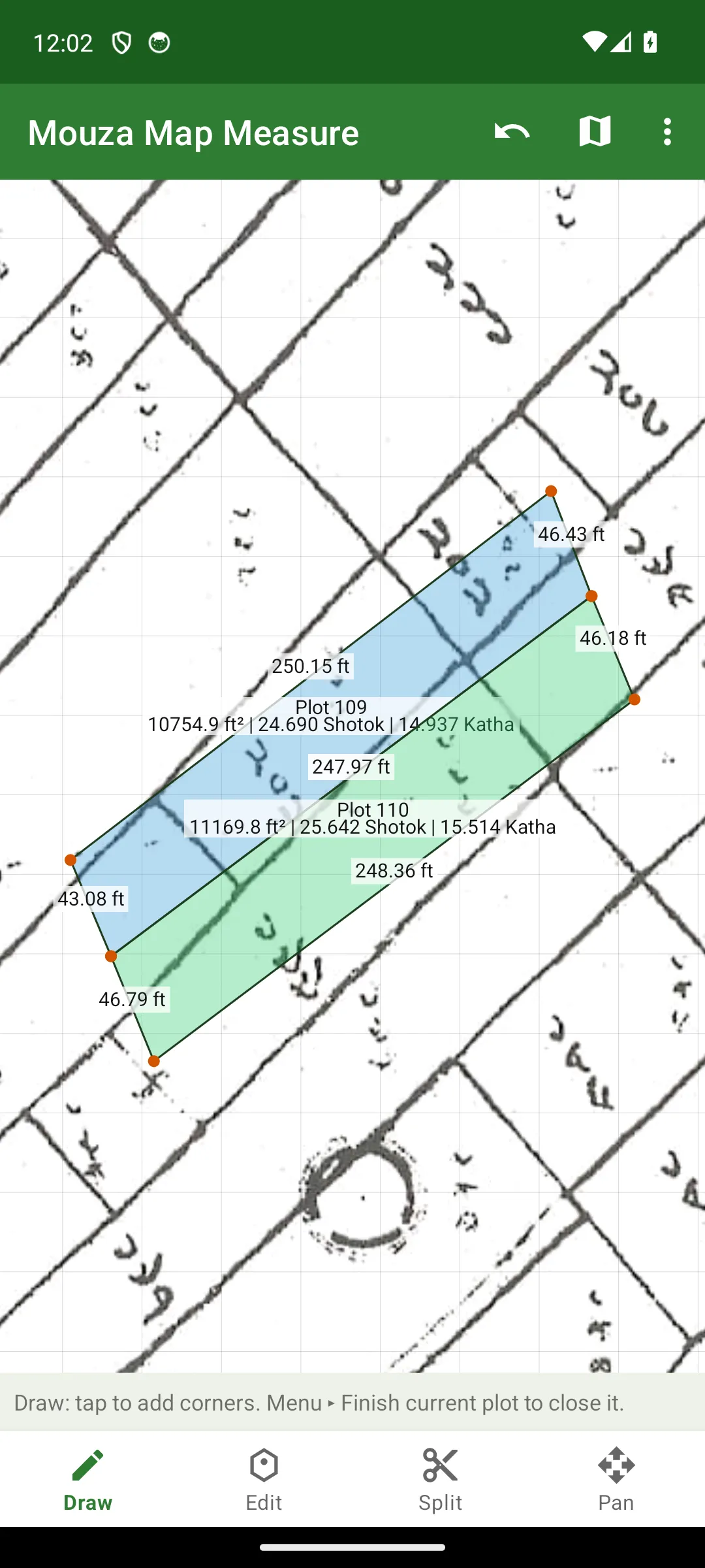 |
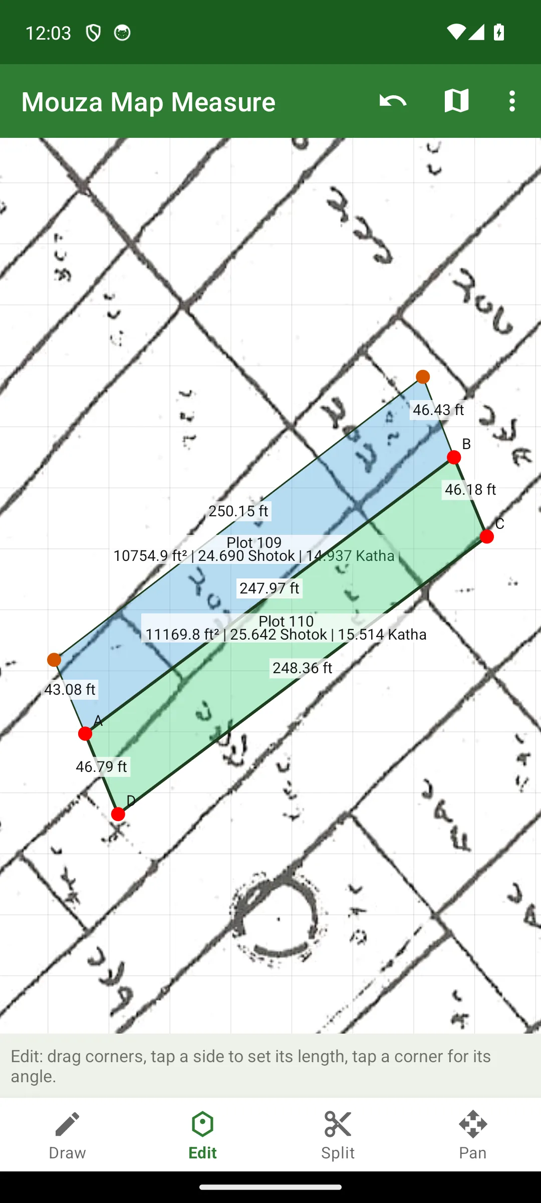 |
| A real mouza sheet loaded - trace the dag boundaries and read Katha/Shotok instantly. | Drag any corner to match the map perfectly; lengths update live. |
| Type exact side lengths | Full breakdown, on the map |
|---|---|
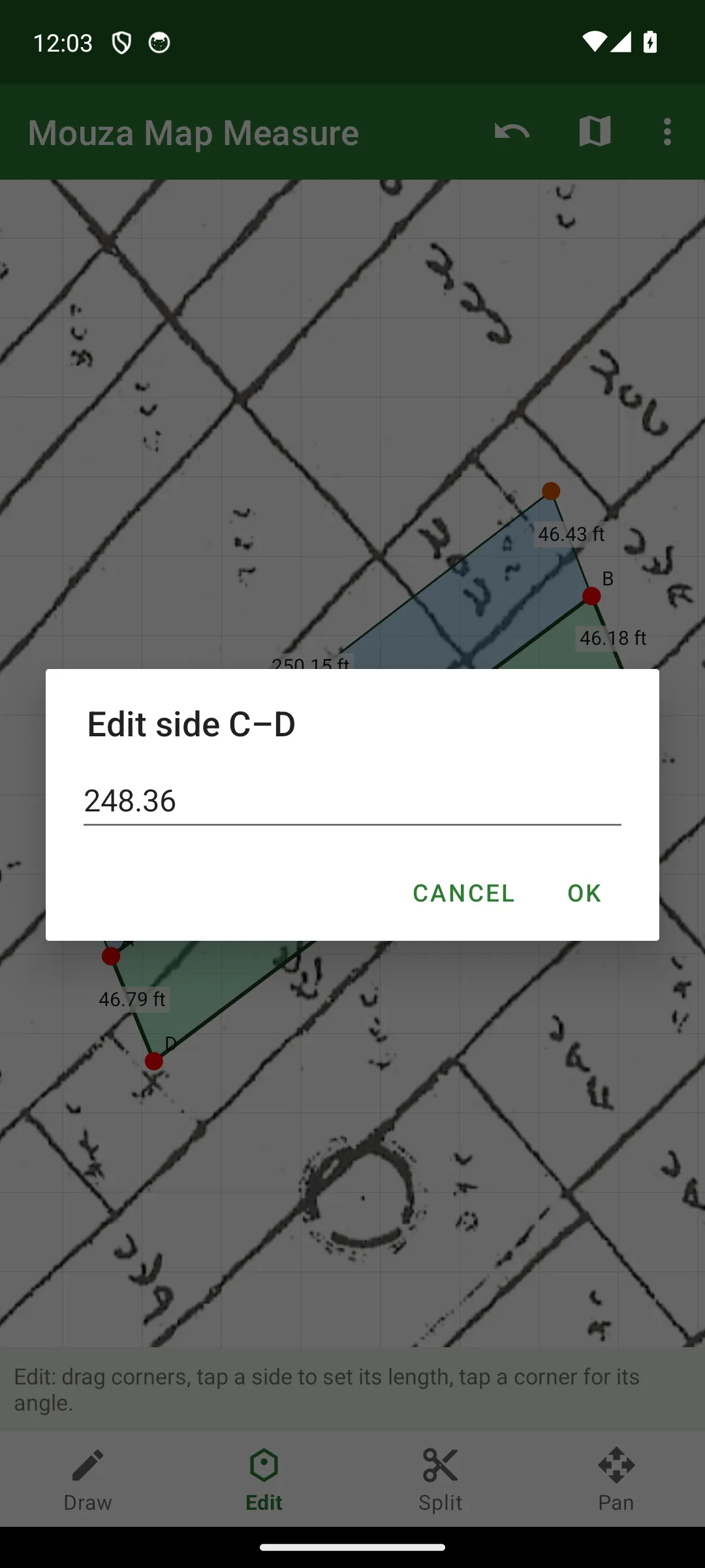 |
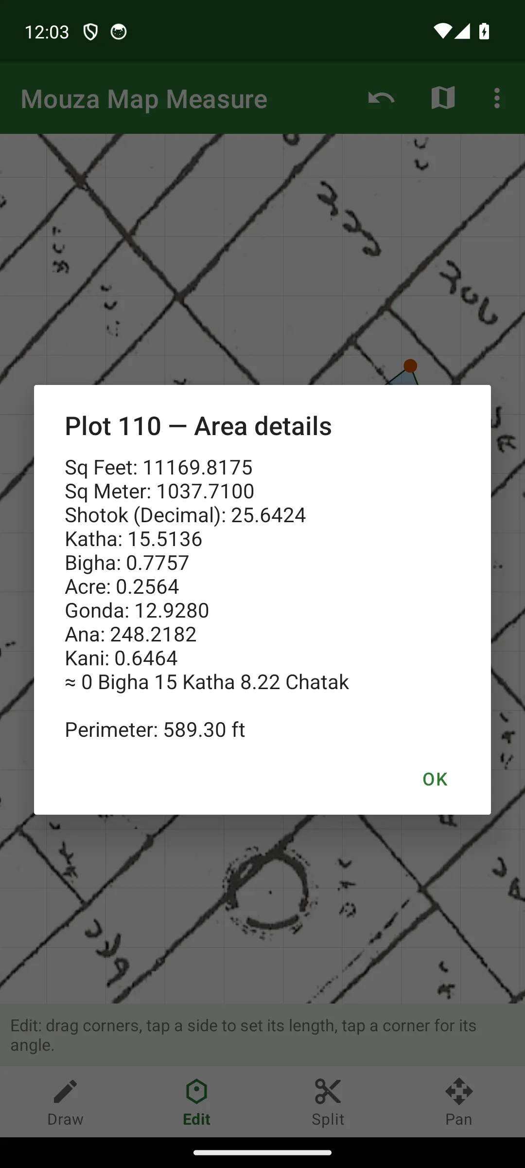 |
| Know a side from the deed? Tap it and type the exact measurement. | Every unit - Shotok, Katha, Bigha, Gonda, Ana, Kani - for the traced plot. |
Who is it for?
- Surveyors & amins - replace paper-and-pencil triangle calculations with instant, error-free geometry.
- Landowners & families - check your plot’s real size before you buy, sell, or divide.
- Engineers & developers - quick site-area estimates from a mouza map or site sketch.
- Land buyers - verify the seller’s claimed Katha/Shotok on the spot, offline.
Notes
Measurements are estimates for reference and planning - not a substitute for an official government survey or legal land records.